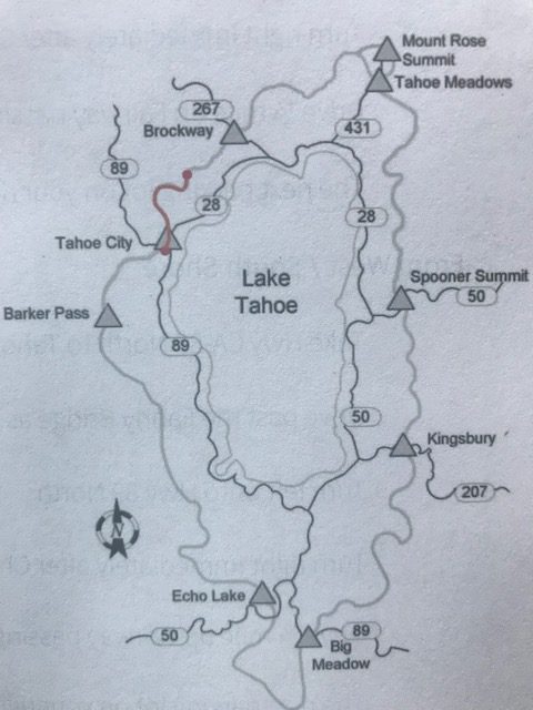
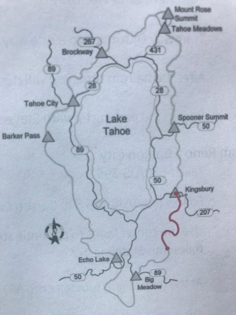
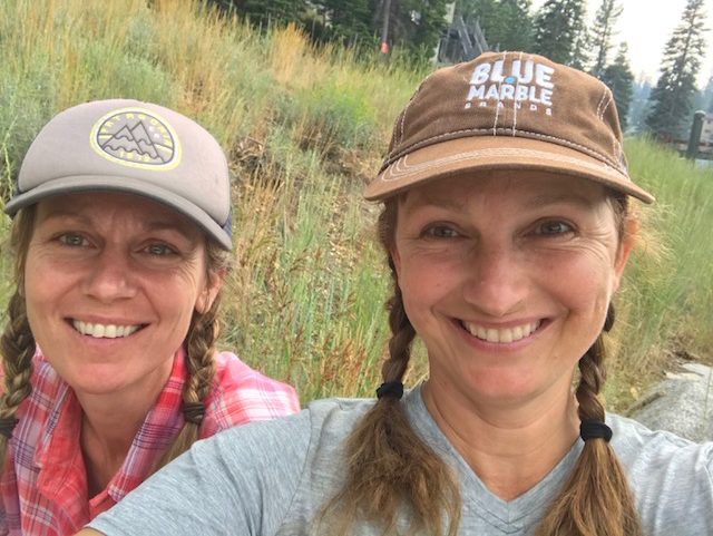
Tahoe Rim Trail Adventure
View of Sand Harbor from Christopher’s Loop
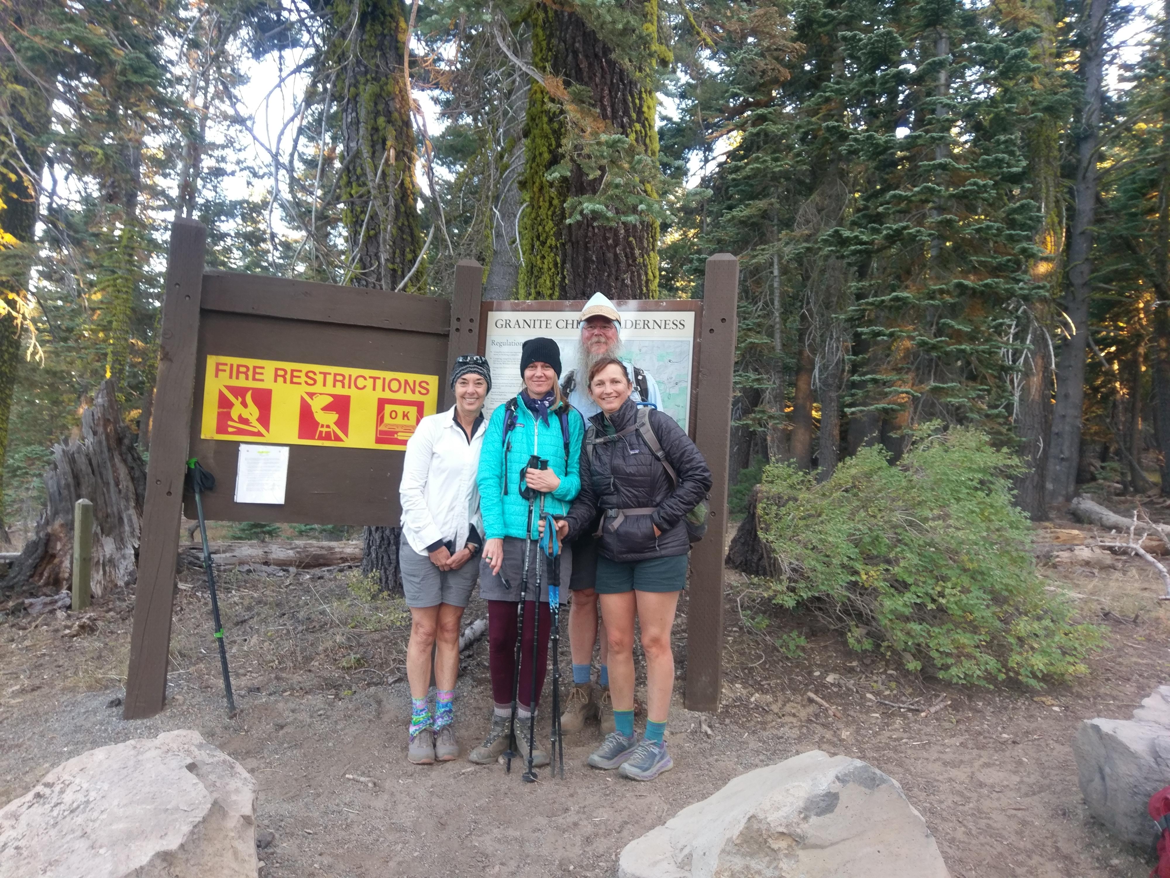
This begins the adventure of hiking the Tahoe Rim Trail each week this summer for a total of 167 miles*. It will include my favorite native plant sighting from each trip as well as some whining about sore muscles and stories from the trail. *Note: I thought it was 167, but it turned out to be 191 due to the added miles of hiking to and from the trailheads. If hiking the “through-hike” and going on the trail every day in a row instead of once each week, then its 167 miles.
Trail Survival Tips: (Wednesday TRT hikers, 2018)
Pre-Hike
- Invest in top of the line hiking boots or trail shoes.
- Put lots of training miles on your feet before starting to hike the trail.
- Rest adequately prior to you hike.
- Eat a big breakfast before starting to hike.
- Estimate driving time to trailhead and add 15 minutes.
- Plan lodging in advance if you need to stay near trailhead to make it on time to an early hike.
- Take an aspirin the day before and the morning of a hike to prevent elevation sickness.
- Avoid drinking alcohol for three days leading up to the hike.
- Start hydrating several days ahead.
- Bring a small towel to moisten in cold mountain lakes.
- Wear wool blend socks.
- Bring a UV protection button up shirt.
- Purchase UV protection lip balm.
- Use moleskin, etc. on trouble spots prior to hitting the trail.
- Bring approx. 1 L of water for ever 5 miles (or have a way to filter it)
- Bring a hat to shade your face from the sun.
- Dress in layers.
- Make sure to have back up battery charger for camera.
- Bring hand sanitizer.
- Pack a lunch you actually will look forward to eating.
Hike Survival tips
- Stash snacks in hip belt pockets.
- Put camera in an easy to access spot.
- Take care of your feet when they first hurt, before its too late!
- Put your feet up during breaks.
- Soak your feet in a high alpine lake.
- Change your socks half way through the hike.
- Bring a pair of trail sandals and change your shoes half way (if the terrain isn’t rocky).
- Suck on hard candy when climbing the hills.
- Hydrate. Hydrate. Hydrate.
- Remember to keep a sense of humor – laughter and stories help!
- Stay positive.
- Look up and take in all the beauty.
- Take TONS of pictures (but not while navigating rough terrain).
- Smile and enjoy the hikes. You may not ever get the chance to come back.
Favorite Trail Food
- Peanut butter pretzels
- Skratch energy chews
- Chinese ginger (helps with the altitude)
- Salty snacks – Beef Jerky, Salty Plums, Corn Chips
- Dried Mangoes
- Add EmergenC or Aclimate powder to water ahead of time or if you start feeling depleted
- Pack real food not just snacks, like a burrito or pizza
Post Hike
- Ice sore muscles.
- Stretch.
- Don’t plan to be productive or talkative after you finish.
- Write notes after every hike so you remember your favorite moments.
Tahoe Rim Trail
Segment 1: Kinsbury North to Spooner Summit South
Hike 1
Miles: 13.3
Hours: 6:02:07
Highest Altitude: 8,837
Ascent: 1,855
Descent: 2,517
Date: June 24, 2018
Hike Rank: 5 stars for views of the lake while hiking
Favorite Flower Sighting: Snowplant
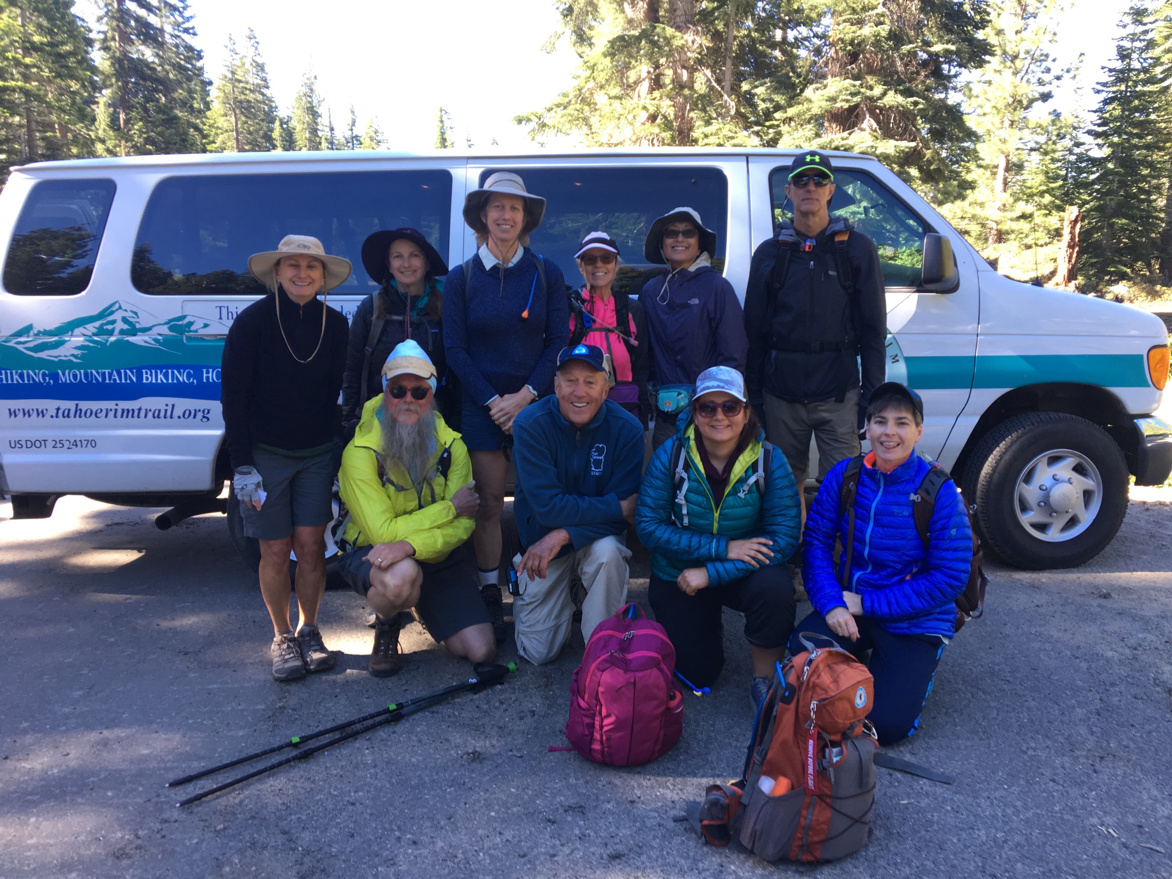
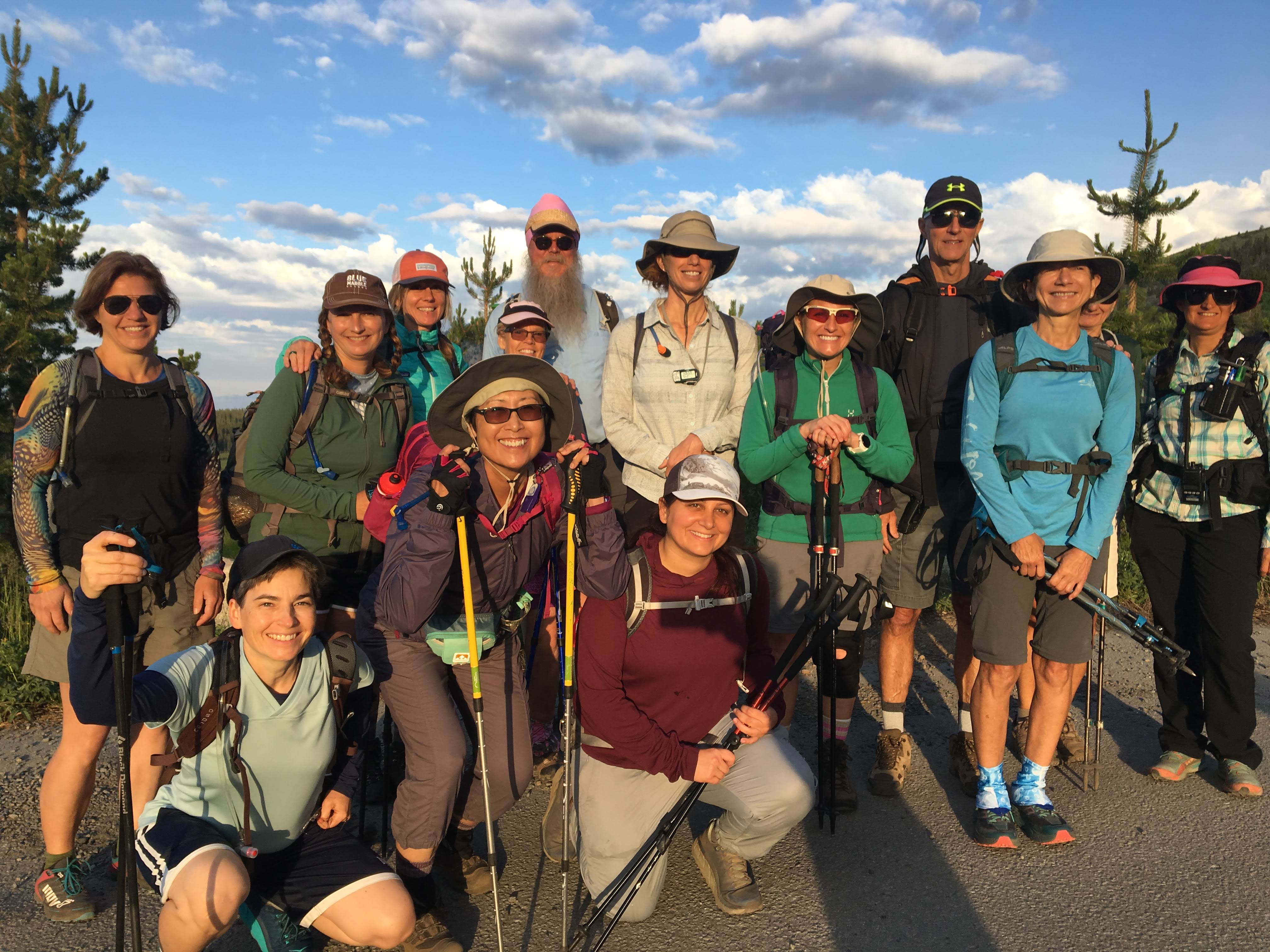
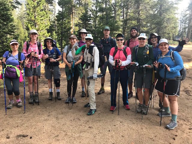
At 8 am, we met at the end of the trail we were going to hike. After a brief introduction, our group of two men and eight women climbed into the Tahoe Rim Trail Association van and departed. I was nervous and spent much of the previous night waking up to check the alarm was going to go off. I had been told that anyone who couldn’t keep the 2.5 miles per hour pace would be cut from the group.
My training had begun in March after I was one of the lucky people to log onto the association website and sign up on February 14th, 10 am before the 10 slots were filled. The sad news was my friend who had gotten me into this challenge had trouble signing in on the internet at work and only made it to second on the wait list. I offered her my spot but she said she would just train with me and see what happened. Maybe a few people would drop out.
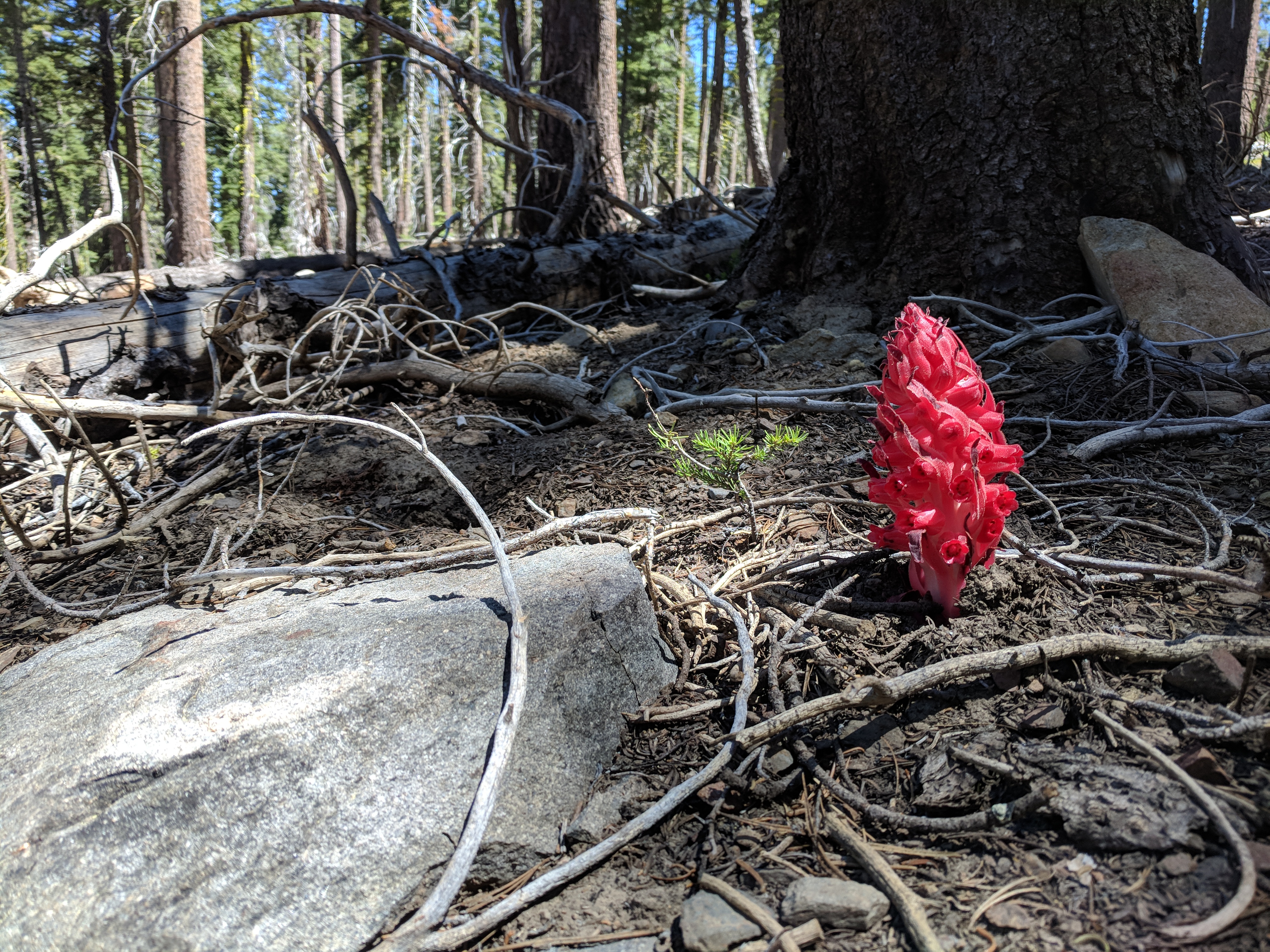
Snow Plant (Sarcodes sanguinea)
The hike was strenuous but not as hard as I expected. The other participants chatted with me as we hiked and so the time passed quickly. I learned its important to choose where in the line you hike and made sure I was behind someone who offered interesting and distracting conversation during the tough hills. The guide in front rarely looked back to see if we were with her, but she did pick some beautiful spots to stop and catch our breath and an amazing lunch spot which we shared with some mules who looked a lot more adapted to the trail conditions than we were.
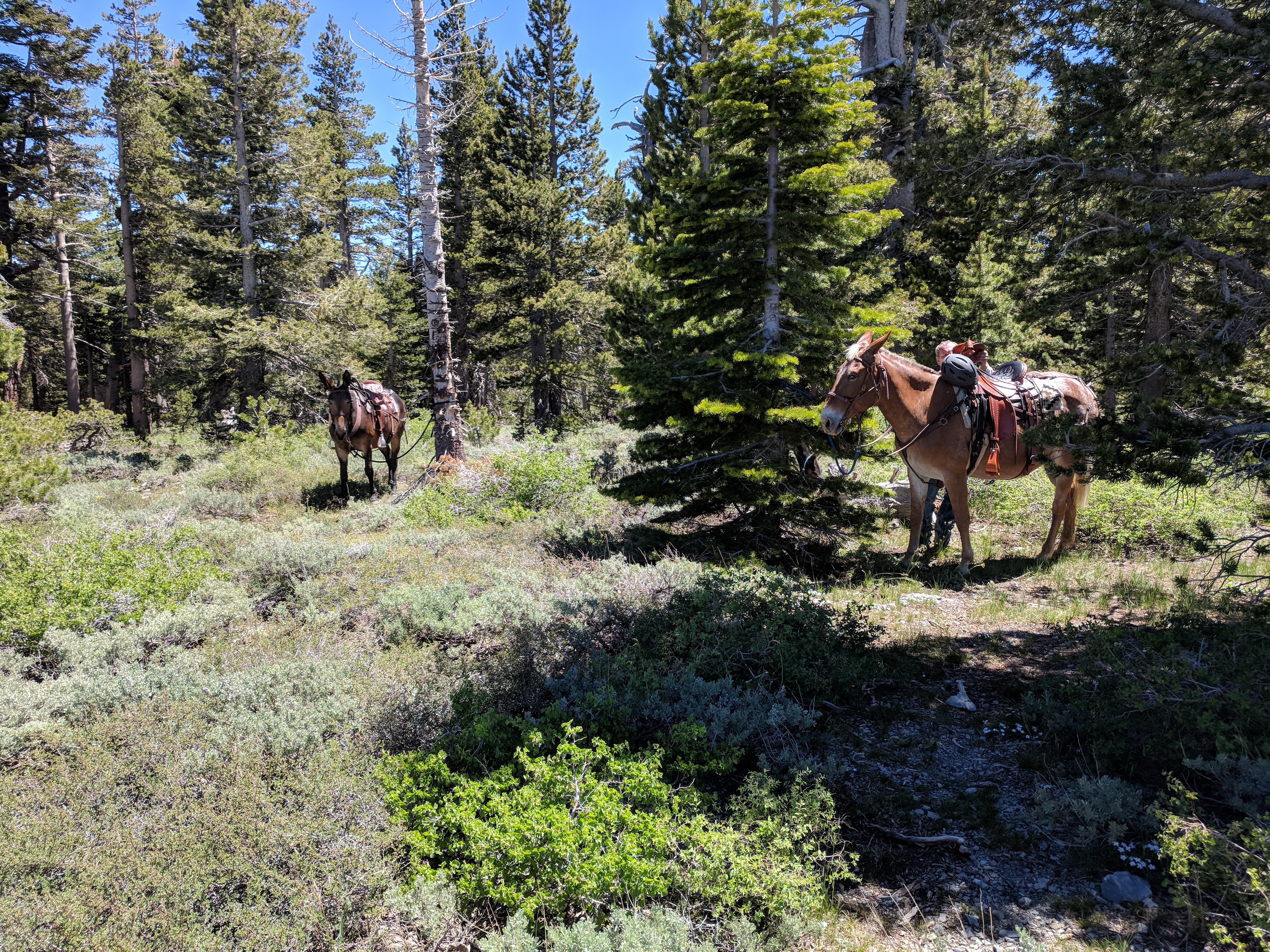
Pack Mules
Why were people doing the hike? It required contributing financially to the Tahoe Rim Trail Association ($645), giving up every Sunday for 11 weeks, commuting up to 2 hours early in the morning to hikes typically departing from 6 am -7:30. It involved hiking for hours on end with strangers and asking your feet and other body parts to do something they would regret at the end of they day. It seemed the most common reason was to get to know the area better and to overcome a challenge. Several of the participants were wearing knee braces or had recovered recently from surgery. The youngest in our segment was 35 and the oldest was 70. I found out the Wednesday rim trail group had a participant who was 80 which inspired me and stopped my mental doubts. If they could do it, so could I.
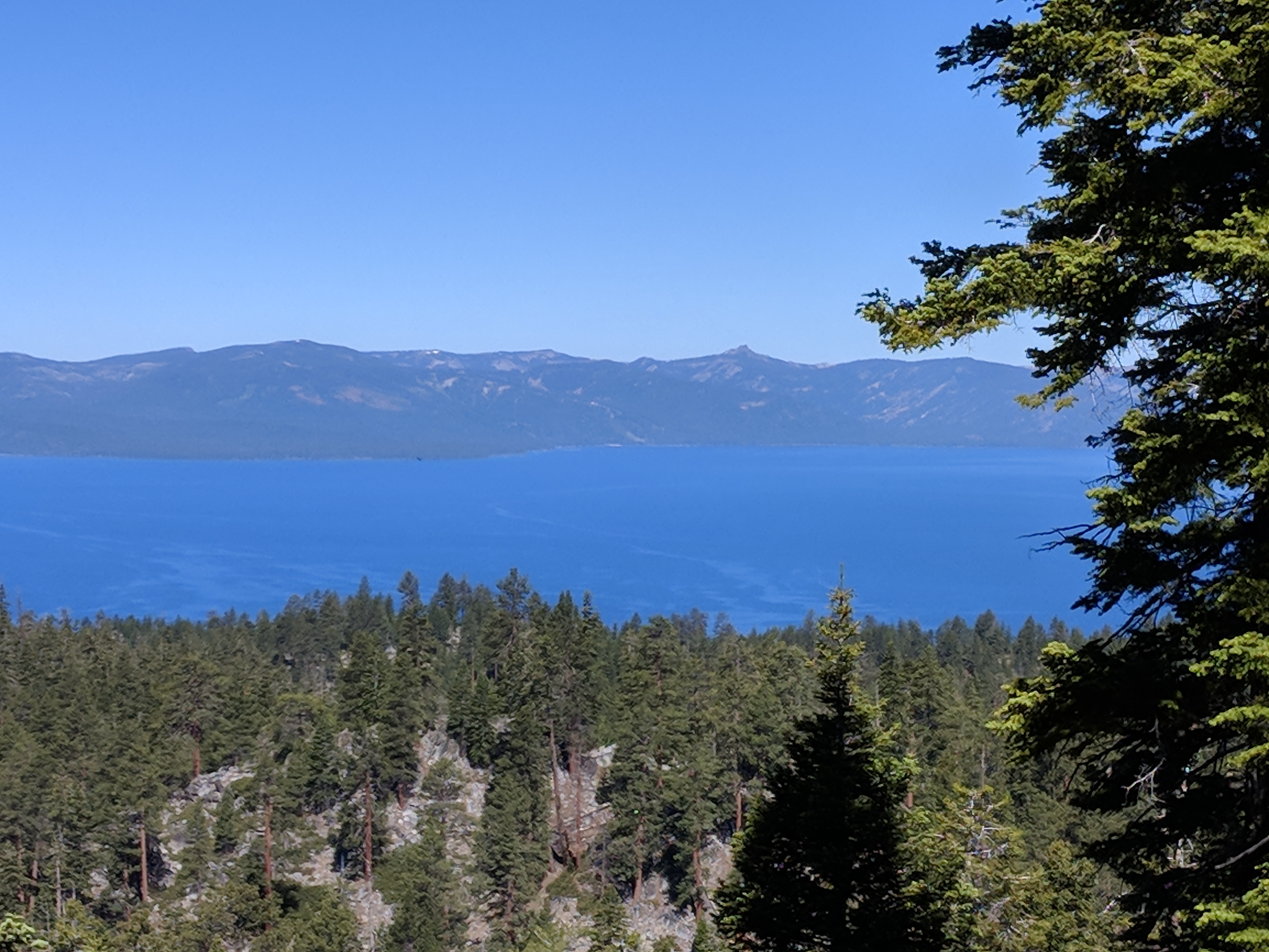
View of Tahoe
Segment 2: Brockway to Tahoe City South
Brockway to Tahoe City South
Miles: 20.5
Hours: 9:34:59
Highest Altitude: 7,892
Ascent: 2,738
Descent: 3,409
Date: July 1st, 2018
Hike Rank: 2 stars for views of the lake while hiking (best views were during the final 4 miles when we were too tired to enjoy them)
Favorite Flower Sighting: Thimbleberry
This hike scared me. It was my first time hiking over 20 miles. The longest training hike I had done was 16 miles. I woke up at 4 am, left the house at the way too early time of 4:45, and was on my way to the 6:30 am rendezvous spot. We had three people join the group that had missed the first segment, including one of the women I had met and done training hikes with. She was nursing blisters and hoping her feet could withstand the journey.
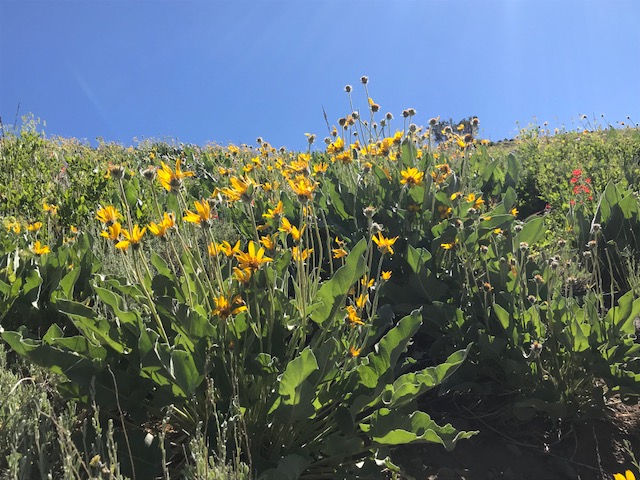
We encountered beautiful meadows of Mule’s Ears, a furry-leaved sunflower that covered entire stretches of the viewshed. My favorite plant of the hike was the stands of Thimbleberry, blossoming in the areas shaded by trees. I have been nursing along some Thimbleberry I planted around my house for the past five years and I’ve finally gotten to enjoy tastes of the fruit. This plant is designed to thrive in the higher elevations and all the plants we encountered were covered in white blossoms.
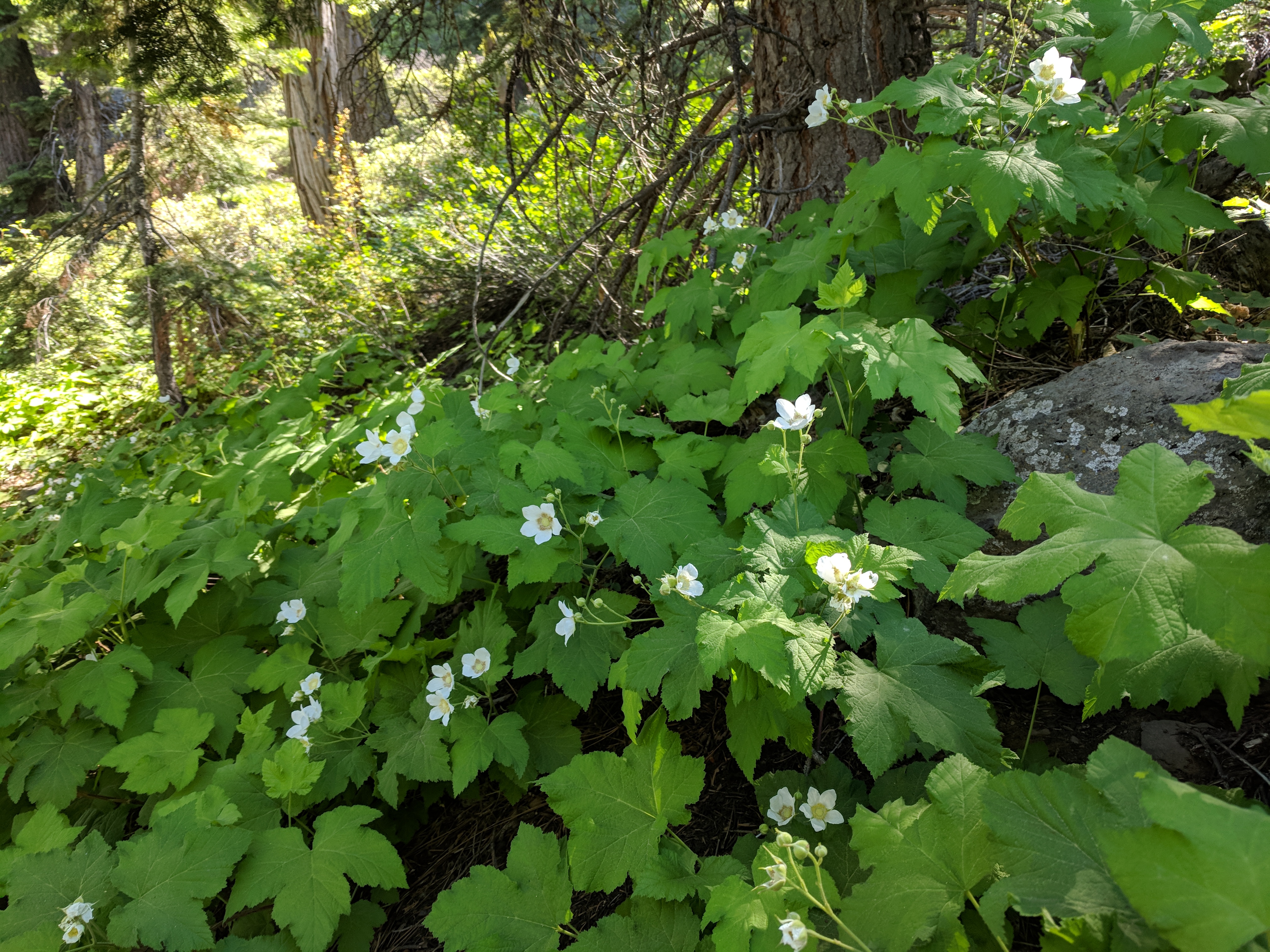
Thimbleberry (Rubus parviflorus)
During lunch, the guides helped my friend tend to her blisters, which at this point covered several toes and the bottom of her foot. I changed into a pair of hiking sandals I brought in my pack to prevent the progress of a few blisters on the side of my feet.
The hike was beautiful but we didn’t reach any views of the lake until the last few miles. At that point, we had gone up some good hills, down and up again then repeated it several times. There wasn’t the satisfaction of a big up followed by a big down. Two participants slipped during the hike going downhill on the loose gravel. They both recovered quickly, and after a thorough check and bandage of some minor cuts, they kept on going. I was proud of the resilience shown by my fellow hikers despite the injuries and the long day. At mile 16, I was too tired to really enjoy the view and kept thinking we must be almost back to the car, which is the wrong thing to focus upon.
Once finally at the car, I zipped toward home, but stopped to dunk my tired feet in the cold Truckee river. In the icy water, my feet started to forgive me. Unfortunately, I heard the next day that my training buddy’s feet weren’t willing to move forward with the next segments. She was dropping out. I felt sad, since I enjoyed hiking with her and getting to know her. The only good news was that she opened a spot for my Nevada City friend who first suggested the crazy idea of hiking the rim trail.
Segment 3 : Armstrong Pass to Big Meadow

Armstrong Pass to Big Meadow
Miles: 11.8
Hours: 5:25:44
Highest Altitude: 9,469
Ascent: 1,613
Descent: 2,578
Date: July 8
Hike Rank: 3 stars The best views were of meadows of wildflowers and there were a few distant lake sightings.
Favorite Flower Sighting: This week it was actually a tree called the Sierra Juniper (Juniperus grandis) which was at least a hundred years old and going strong the way I hope to be.
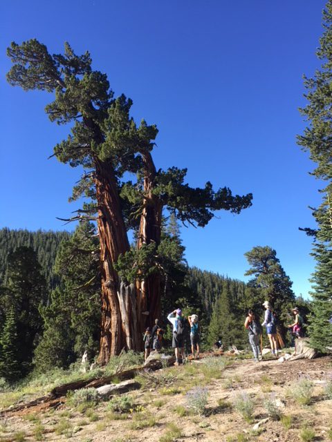
Sierra Juniper (Juniperus grandis)
 The first four miles of this hike, going from 8,292′ to 9,461′ at a speed that felt like a run, made me question my decision to undertake this challenge. I started to forgive our guide when she took what she rudely called a “granny” break, a two second pause for the people feeling or hiking like an ancient grandmother. She actually stopped for almost a full three minutes to point out an enormous wind-swept tree called the Sierra Juniper.
Other highlights of the hike were incredible meadows blanketed in wildflowers, including Penstemon, Paintbrush, and Mule’s Ears.
After lunch with a view of the lake, the hike meandered downhill until we began to hear the sounds of cars, reminding us we were rejoining the rest of the world. It was a fairly easy, beautiful hike that I would recommend for a range of hiking levels.
Segment 4: Tahoe Meadows to Spooner Summit North
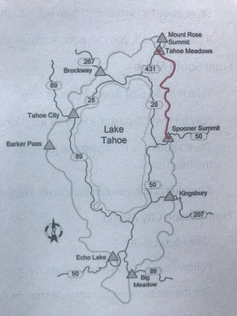
Tahoe Meadows to Spooner Summit North
Miles: 25
Hours: 11:21:36
Highest Altitude: 9,004
Ascent: 3,087
Descent: 3,753
Date: July 15th, 2018
Hike Rank: 5 stars
Favorite Flower Sighting: Corn Lily
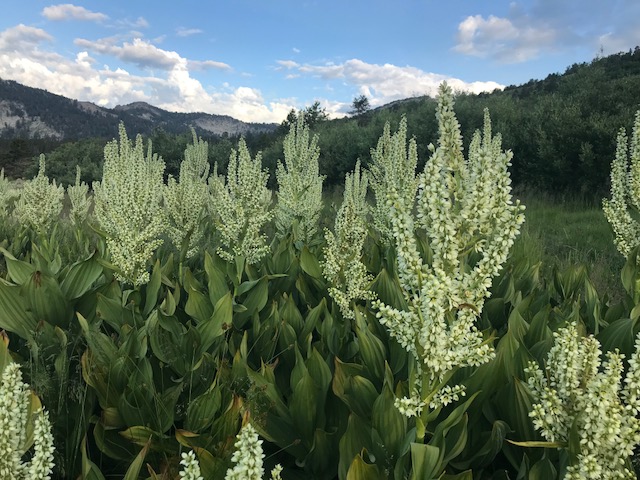
Corn Lily (Veratrum californicum)
The hike started out through a meadow of Corn Lilies, brilliant in the early morning light. The first nine miles were a visual treat of wildflowers and terrain that was flat enough for our group to chat cheerfully to each other. It would be a beautiful hike to just head partway along this trail to Twin Lakes and then return. After passing an almost dry lake, we started a series of switchbacks and ups followed by downs, causing the friendly banter to quickly diminish. When I asked if we were headed for a particular vista, our guide taught me an important new word. She explained we were doing, ‘puds,’ meaning pointless ups and downs. Good to know. About when I thought we should receive gold medals for our brave tromping long distances in the early morning, we were passed by several sets of happy trail runners, zipping past us up the trail with smiles on their faces. Maybe that would be me next year?
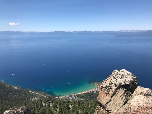
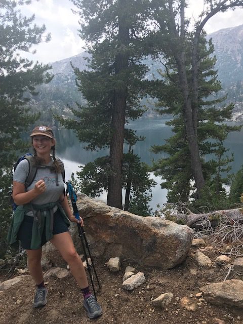
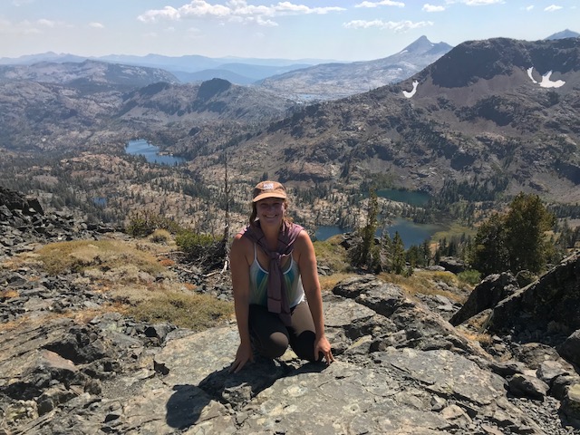
We did finally reach our lunch break at Christopher’s Loop, an optional extra mile to see a view of Sand Harbor. I had read about it’s unbelievable beauty, so despite my aching legs, decided to do it. As my friend pointed out, we will likely never do this again, so we might as well go see it. Two other adventurous group members joined us and the rest wisely rested in the shade of the nearest tree to enjoy a peaceful lunch. The stunning views of the full expanse of Lake Tahoe and the turquoise waters of Sand Harbor made the hike worth it. We posed for a few photos, took in the view, ate a few bites of lunch and then were told it was time to renew our trudge.
View of Sand Harbor from Christopher’s Loop
Hiking through an expanse terrain of wildflowers on the edge of a mountain, overlooking both Marlette Lake and the vastness of big blue, helped me forget about my aching feet.
While we stopped for a ‘bio’ break, another essential to know, polite term meaning someone has to visit nature’s bathroom, we joked about the fast pace our guide had set. She apologized and decided to give another guide a chance to set a slower pace. I’m not sure if it was a cruel joke but the ‘slow’ guide who took over at the bottom of a significant climb, took off up a steep series of switchbacks at what felt like a jog. I thought my lungs might explode, she hadn’t glanced back to check on us, and even the fastest members of the group were starting to turn red and pant. The slower members had been left in the dust long ago. I wondered to myself if she really preferred hiking on her own, since most of the group was not even in her sight. I finally swallowed my pride, asked for a break and told her in an edgy voice, interspersed with gasps for air, that the pace wasn’t sustainable. It seemed like a generous way to describe my feelings. She did her best to slow down, but it was like asking a rabbit to stop hopping.
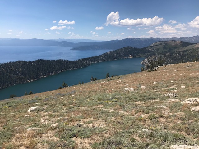
Marlette Lake (7823′) and Lake Tahoe
The last four miles seemed to lengthen into what felt like another fourteen. I’m not sure how that happened, but we reached deep to find anything interesting to talk about to distract us from the tingling pain in our feet. There were quite a few moments of complete silence since our brains also seemed to have fried in the 11 hours of sun and dust. In the quiet I began to wonder more about the reasons people do these long hikes. The guides are volunteers choosing to do this in their free time. How much is the hike about the nature experience, how much is about personal accomplishment and how much is an ego-driven desire to impress others? For me, whatever ego I might have had was left behind at one of the ‘granny’ breaks. It was all about the beauty—multitudes of flowers and a bird’s eye view of the most beautiful lake in the world.
Segment 5: Armstrong Pass to Kingsbury South
Armstrong Pass to Kingsbury South
Miles: 16
Hours: 8:10
Highest Altitude: 9717
Ascent: 35, 2090
Descent: 235. 2970
Date: July 22nd, 2018
Hike Rank: 3 stars
Favorite Flower Sighting: Tree – White Pine (circumference of 24’)
Here we go again..
The trail traversed mountain passes as well as open meadows and forests and close to Freel Peak (10,881), the highest peak in the Tahoe Basin, until it descended into Star Lake. We ate lunch overlooking the lake. Unfortunately, one of our crew toppled into the water when we were crossing some rocks and her shoes were completely filled with water. She didn’t complain once and just laughed it off as all part of the adventure.
Past the lake, we descended a sheer and rocky trail to the sound of thunder claps, which made my slow gait turn almost to a run. I started wondering about holding metal hiking poles in a lightening storm and how much that might increase my chances of getting struck. In fact, there were no trees around, so the metal poles I was grasping seemed the ideal target.
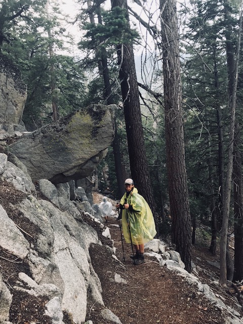
A bit of rain and thunder to keep things exciting!
It started to rain just as we approached the largest tree on the Tahoe Rim Trail, an enormous white pine. With the impending storm, we only had time to give it a quick hug. Our guide made the mistake of telling us we were “almost there” and then we had to hike another 4 ½ miles. I remember learning that lesson as a parent; it’s always better to give a specific amount of time or miles to go on a long trip, and set the right expectations. I’m sure 4 ½ miles to go was ‘almost there’ for our guide, but for me and the rest of the group, it ended up being a long time before we considered ourselves close to our ride home!
Happy at the Finish Line
Segment 6: Echo Summit to Big Meadow
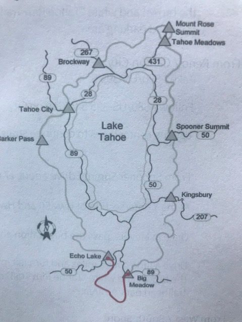
Echo Summit to Big Meadow
Miles: 16
Hours: 7
Highest Altitude: 7,377 Echo Summit
Date: originally July 29th* did it on 9/14, makeup hike and my last hike of the TRT!
Hike Rank: 5 stars due to beautiful meadow views and a moderate amount of climbing
Favorite Flower Sighting: Tree – Quaking Aspen
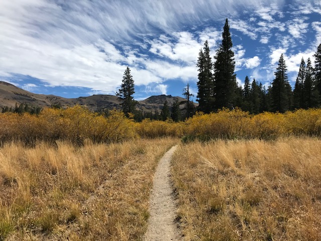
This actually ended up being my final hike and what a beautiful way to end. The views of a series of meadows and lakes were breathtakingly beautiful. Much of the trail overlaps the PCT (Pacific Crest Trail), and although there is quite a bit of uphill hiking, the soft trail of dirt, not rock, the occasional glimpses of Lake Tahoe in the distance, and the vast meadows made me quickly forget the climb. It was my first opportunity to hike without a guide and luckily my hiking companion brought a map we could study at the trail junctions. There were a few signs, and we learned that following arrows pointing to highway 89 were the ones we wanted. Both Showers Lake and Round Lake had stunning spots to camp and Round Lake was only about three miles from the Highway 89/Big Meadow parking lot, though there would be a significant uphill if coming from that direction. Meiss Meadows was lovely even in fall, and in 1878, the Meiss family built their still-standing cabin a picturesque spot, though its hard to imagine how the family got supplies in and out and survived the winter. Maybe the family knew about using Aspen or Willow bark for pain, plant-based sources of salicylic acid (a precuser to aspirin, used from plant sources by Native Americans and in Europe since the time of Hippocrates), and how to use the native plants for food?
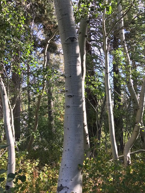
Grove of Quaking Aspen (Populus tremuloides)
Segment 7: Barker Pass to Bayview
Barker Pass to Bayview
Miles: 23
Hours: 11
Highest Altitude: 7650
Date: September 9th, 2018 *makeup hike from the one I missed on 8/5.
Hike Rank: 4
Favorite Flower Sighting: Mountain Pennyroyal
Bravely Setting Forth
Since I had to make this one up, it was a bit anticlimactic after most of the group finished the entire TRT the week before and we already had our big end of the hike celebration. But three of us had missed this hike and were determined to finish, and we were luckily accompanied by a guide who had missed this section the year before.
We started early, which allowed me a rare opportunity to see the sunrise above Emerald Bay. It was going to be a long day, and the worst part was remembering that we faced the Bayview descent at the end. It was a part of the trail we had hiked just the week before (see Wk11), with the rest of the group, a seemingly never-ending descent of uneven rock steps and loose rocks.
Miller Lake
We started out in the cold morning air, a feeling of the coming fall. It was easier to move fast with a smaller group and we enjoyed hiking through tree-lined, dirt paths and meadows of yellowed grass, dried Mule’s Ears and the occasional purple Aster, still blooming in September. My favorite flower of the day, resillient and seen during every weekly hike, was Mountain Pennyroyal. Abundant on every trail this summer, rubbing the skin with the fragrant pennyroyal leaves had helped out those people in the group that the mosquitoes and bugs seemed to love.
We passed a view of Miller Lake and then entered Desolation Wilderness, 63, 960 acres of federally protected forest, originally part of the Washoe tribal lands.
Fontanillis was a stunning lake, a wonderful place to camp or take a refreshing swim. Unfortunately we were in too much of a hurry at that point to stop for a dip. Its definitely on my list to come back to the lake, even though it added two miles to our hike. We celebrated briefly when we reached the top of the trail to Bayview, since it officially marked the trail completion for two hikers in our group. It was a bit too soon for cheers, however, since we then faced another series of uphill switchbacks and then the dreaded descent into Bayview. We made it; barely.
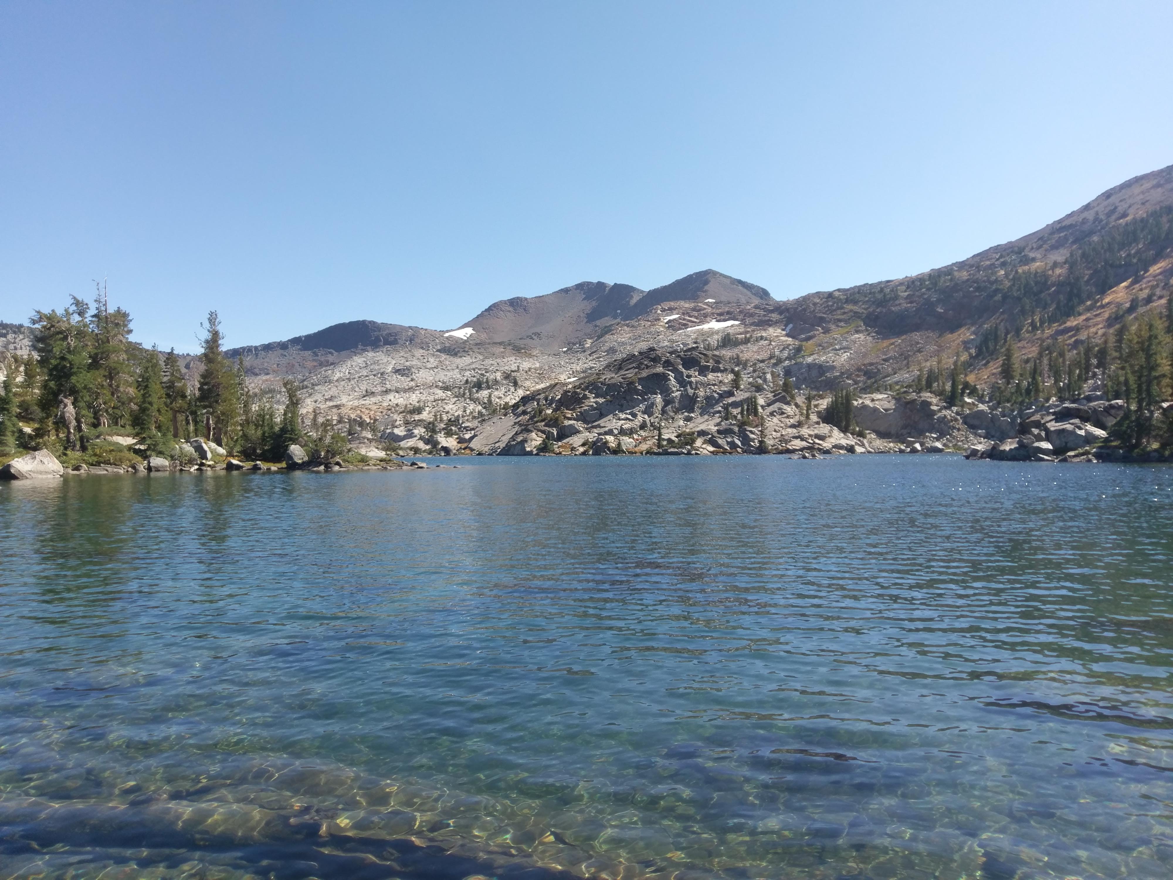
Fontanillis Lake
Segment 8: Kingsbury North to Kingsbury South
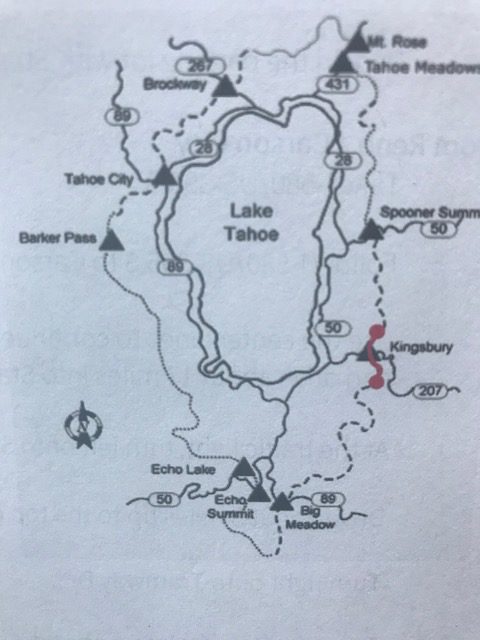
Kingsbury North to Kingsbury South
Miles: 8
Hours: 2.81
Highest Altitude: 7,927
Ascent: 1,247
Descent: 1,305
Date: August 12, 2018
Hike Rank: 4 stars since its good for family hiking
Favorite Flower Sighting: Rubber Rabbitbrush
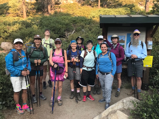
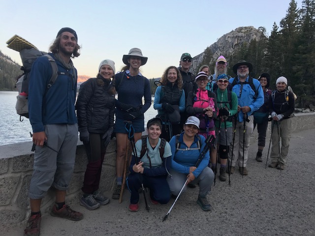
Rim Trail Hikers – Week 8
This hike was wonderful because we had a chance to take in the vistas and really enjoy ourselves. It is also a perfect hike to take with friends and family since it was short, loops back to the parking area and includes beautiful views. It even has optional shorter segments, making it a good option for hikers of any level.
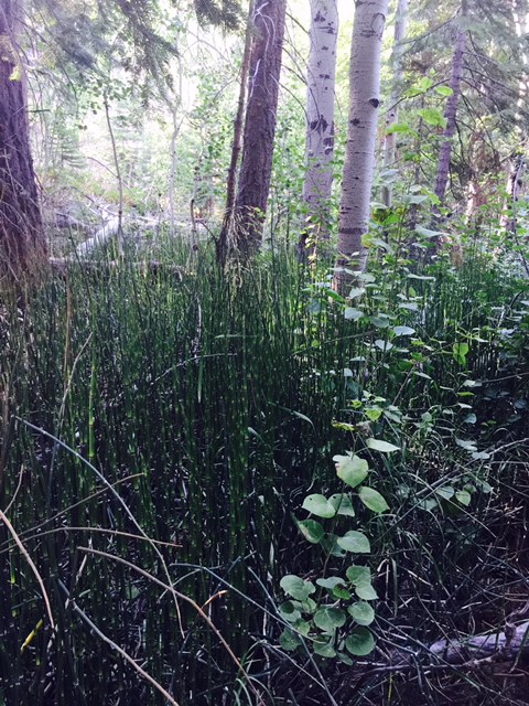 The terrain varied between primarily open, rocky areas and moist sections of creek that include horsetail and aspen.
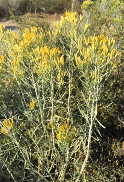
Rubber Rabbitbrush
My favorite flower was Rubber Rabbitbrush (Chrysothamnus nauseosus), blooming bright yellow on sandy, open areas. Its a perennial evergreen shrub containing latex, used in making rubber, which is how it got its common name.
Native americans used bark of the lower stems and roots as chewing gum and the roots themselves were boiled to make a tea to treat coughs and colds. They boiled the flowers to make a lemon-yellow dye.
The trail builders, volunteers with the TRT association, did an incredible job of moving rocks and constructing paths supported by rock walls. It was quite an achievement to build this trail and definitely worth another visit with my family, especially since it was the only hike we took that ends in the same spot we started.
Segment 9: Mt. Rose to Brockway
Mt. Rose to Brockway
Miles: 21.25
Hours: n/a (too tired to look)
Highest Altitude: 10,338
Ascent: 2,619
Date: August 19th, 2018
Hike Rank: 5 stars because of the spectacular views, not the elevation gain
Favorite Flower Sighting: Mule’s Ears. We were able to munch on the thin sunflower seeds, found inside the dry seed pods.
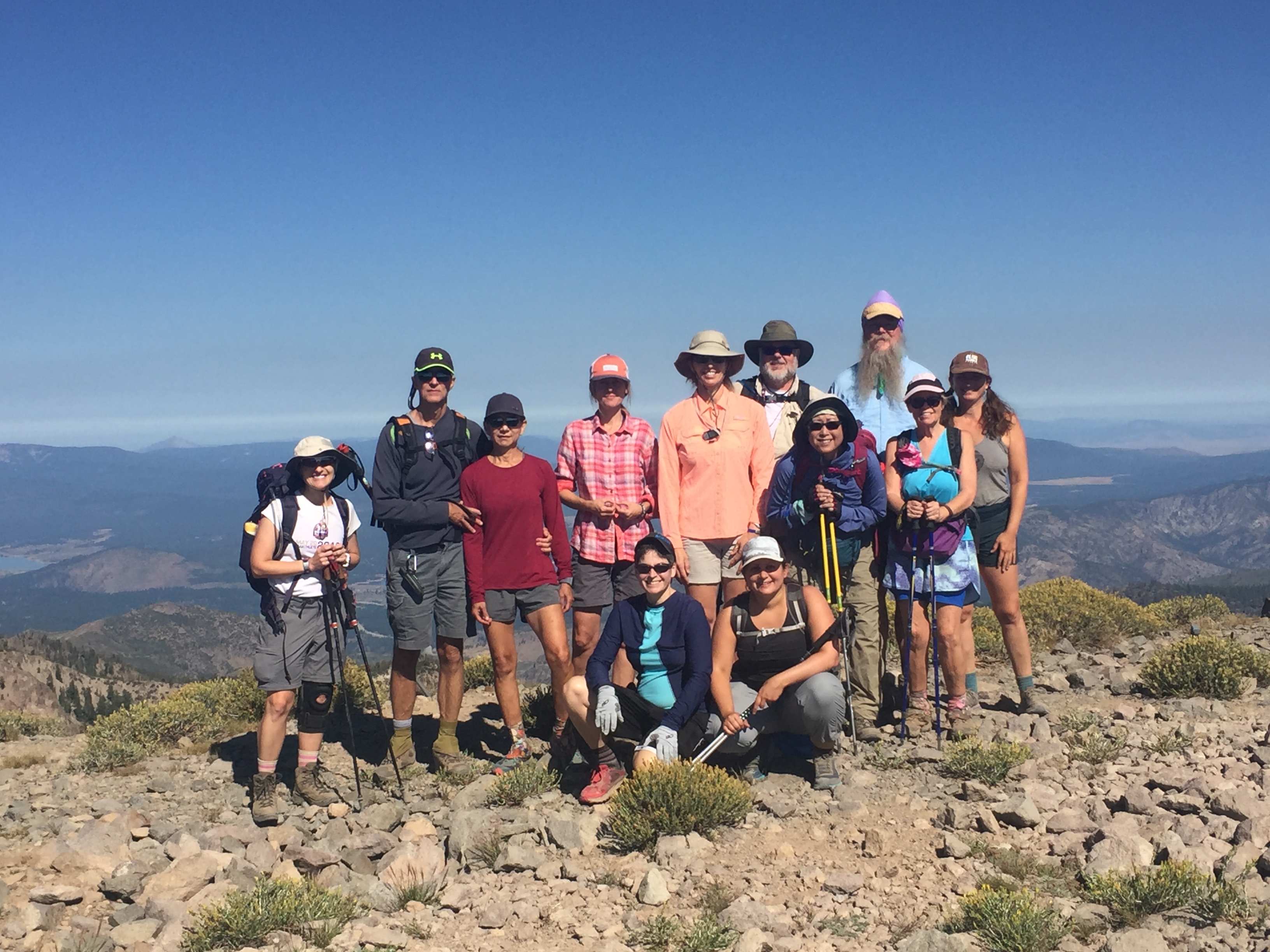
Group at Top of Relay Peak
The climb started out gradually, heading up for about 2 ½ miles until Galena Falls. It was an incredible opportunity to compare changes in my fitness level, since I did the same hike to the falls and then Mt. Rose with my friend Laura, back in early June as part of the training for the rim trail hike. I was surprised how much easier the hike to the falls seemed after a summer of long distance hiking.
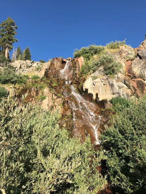
Galena Falls, 8,900′
My main concern was the altitude. When I did the training hike and continued past the falls to Mount Rose, I suffered from a bad case of altitude sickness. I made it to the top, but had to stop every 10 minutes since I felt like I was going to faint. The symptoms were really a combination of nausea and dizziness.
Relay Peak, the highest point on the rim trail at 10,338′, was my main concern. The good news was that most of the climbing happened during the first five miles and then it opened up to about 10 miles of the most exquisite views I’ve seen of the lake and surrounding mountains.
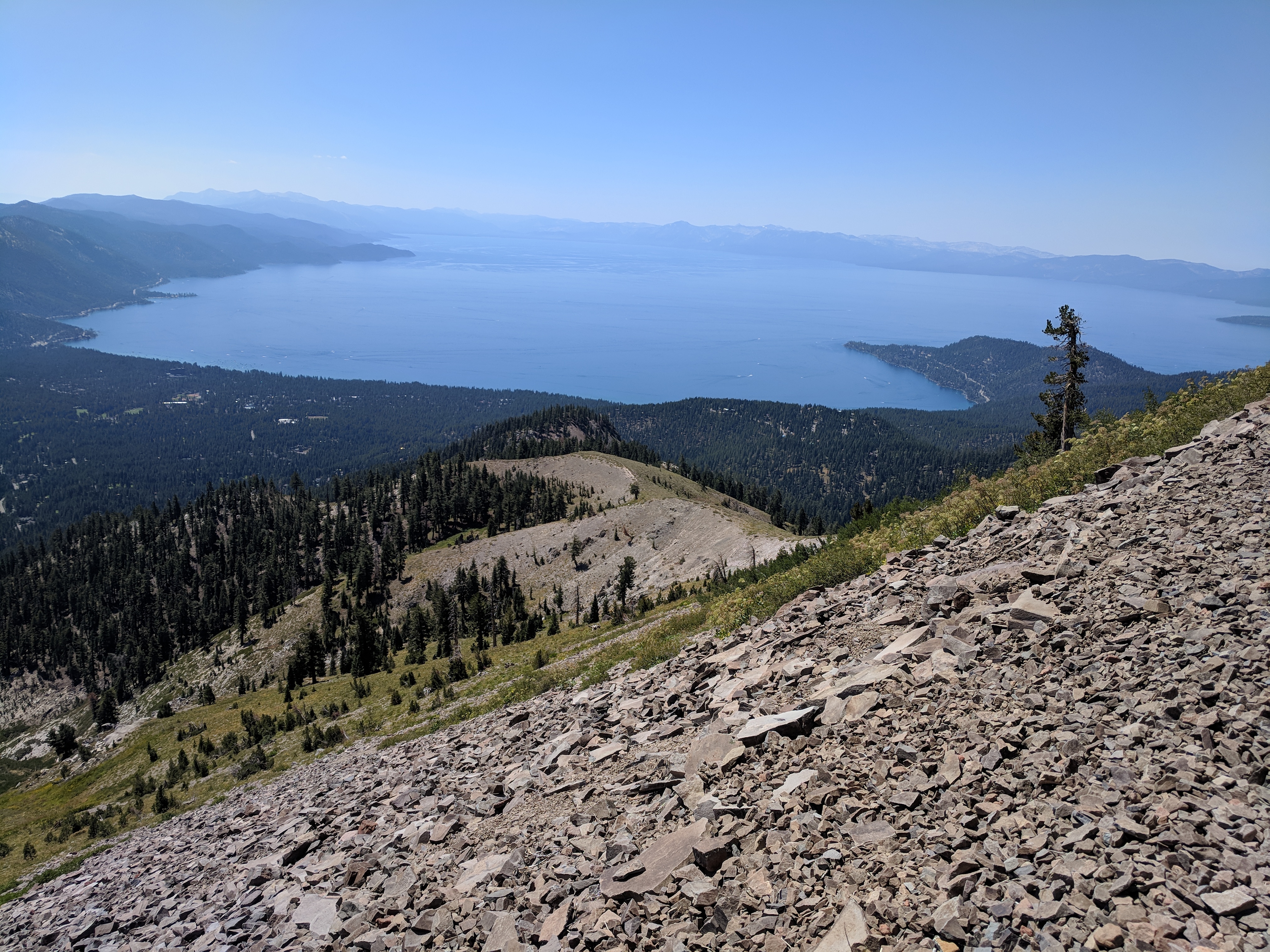
View from Relay Peak, 10,338′
I was searching for a yellow-flowered perennial called the Tahoe Draba, ranked rare and threatened by the California Native Plant Society. Its small yellow flowers are only found at high elevation in a few places around Tahoe, Freel Peak, Monument Peak and Mt. Rose. I offered to buy a cold drink for the first person in our group that found it. Despite staring closely at the ground for hours, we weren’t able to spot it. We did see Pussypaws, with its vibrant pink flowers.
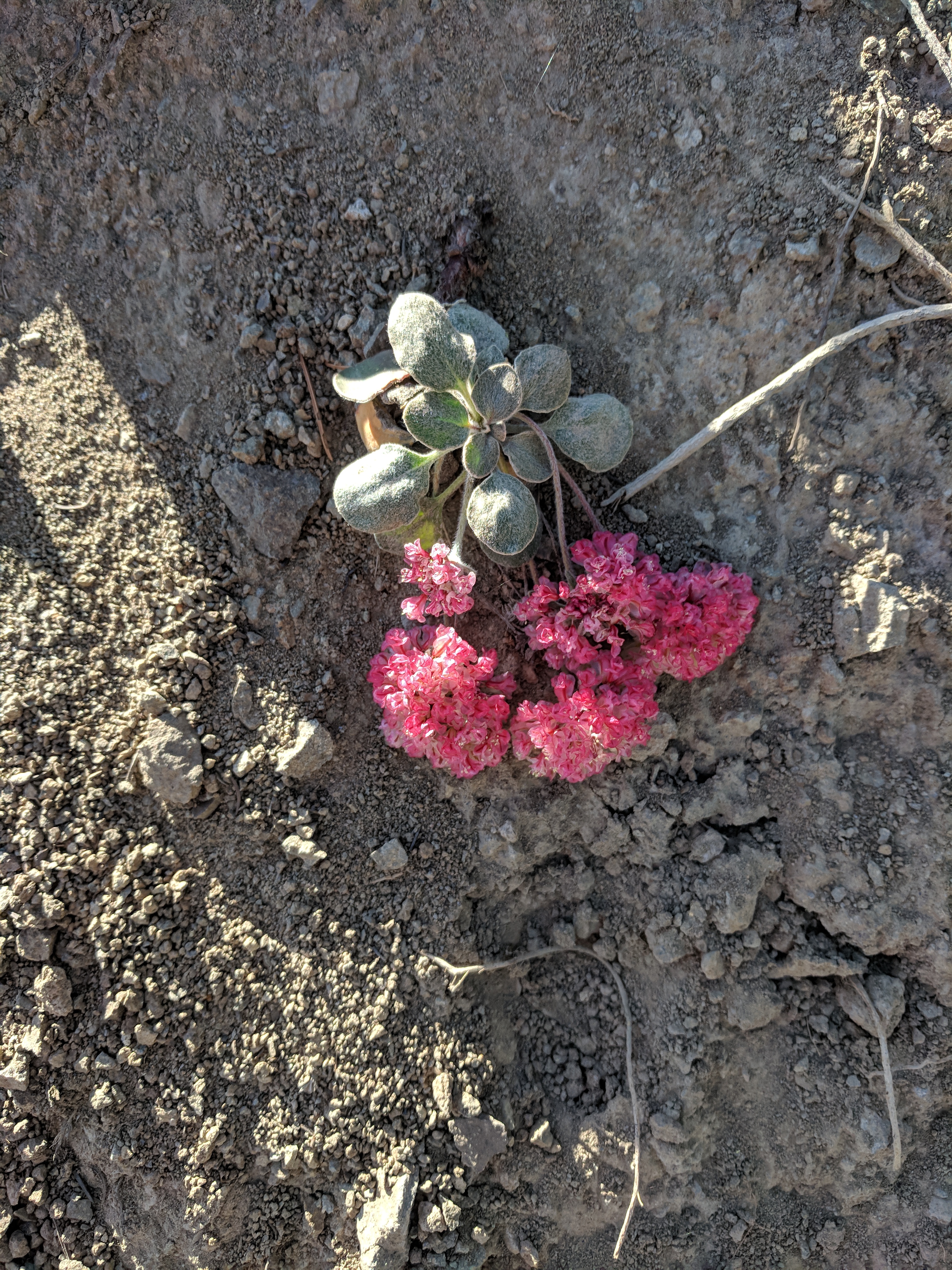
PussyPaws (Calyptridium umbellatum)
As we reached the top of the peak, I did get a headache and felt a little nauseous, as did a few others in the group. We hiked around the edge of Rose Knob, 9,600′ and Mt. Baldy at 9,271′ and the symptoms passed fairly quickly as we started our descent.
This hike was long in high elevation but definitely my favorite so far.
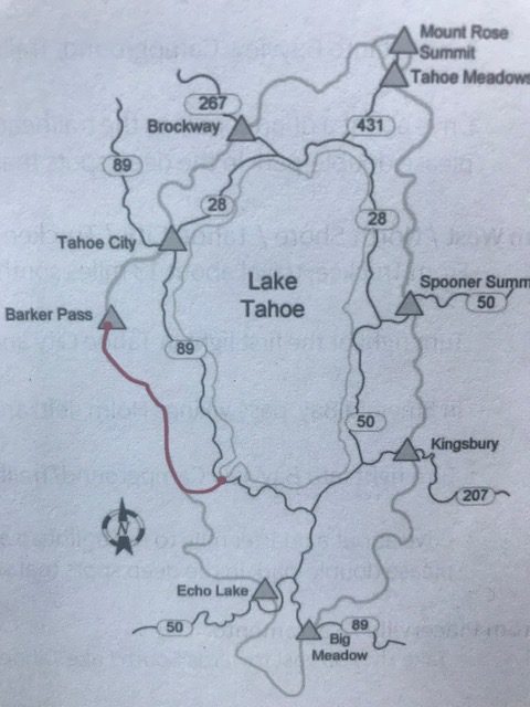
Segment 10: Barker Pass to Tahoe City
Barker Pass to Tahoe City
Miles: 18
Highest Altitude: 7650
Date: August 26th
Hike Rank: 3
Favorite Flower Sighting: Fireweed
Barker Pass to Tahoe City
This hike had the advantage of the steep climb being completed in the first 5 miles. We passed Twin Peaks and then had a chance to cool our feet off in Ward Creek. The simple act of putting my feet into icy water made the rest of the day a breeze.
Fireweed occurred on this trail and almost every trail, and even though its flowerheads had started to dry, it was still beautiful. We did see cars and have to cross a road, well before the end of the trail, which took away from the remote feeling we achieved on most of the other hikes.
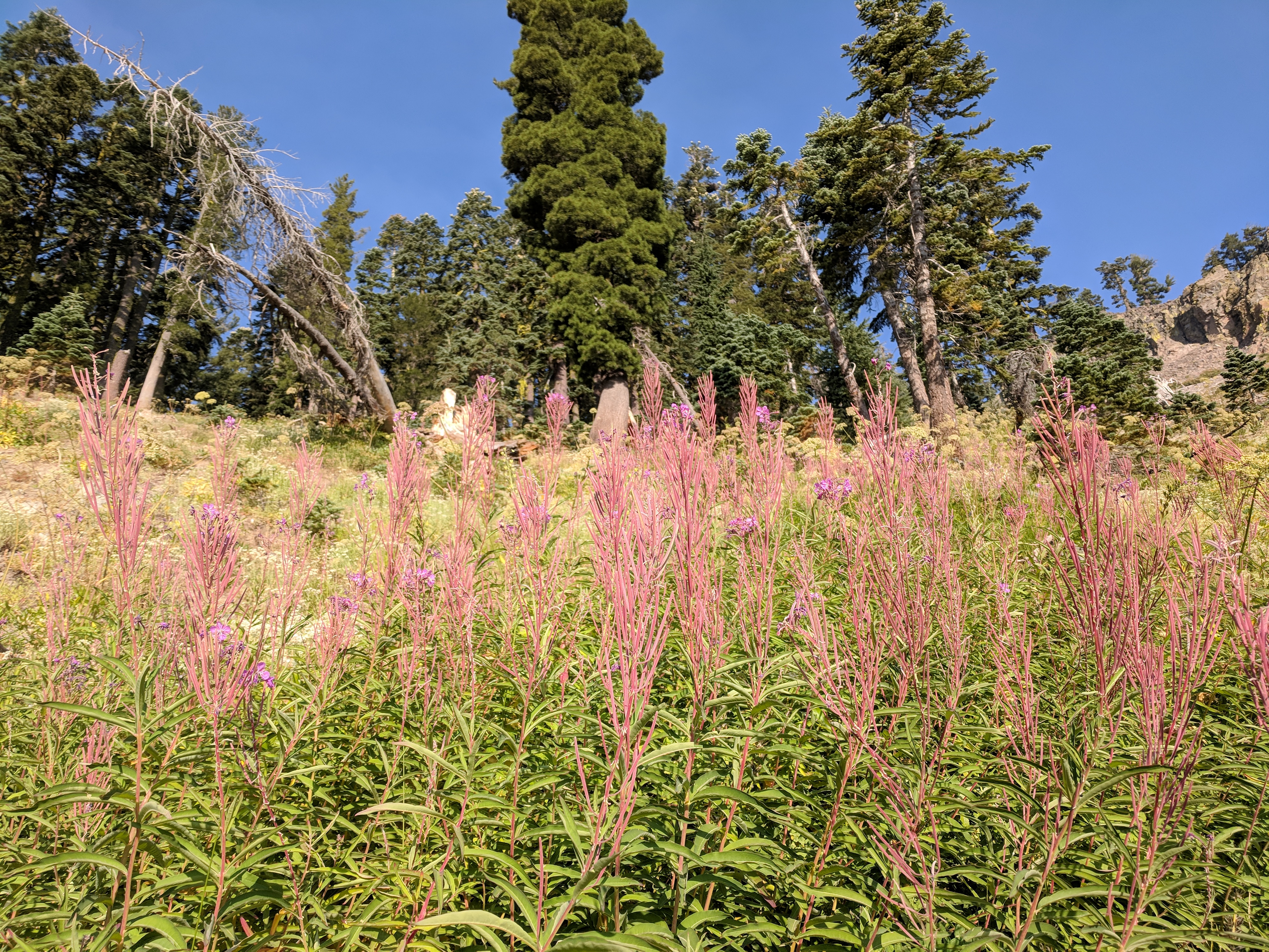
Fireweed
The last part of the trail followed the Truckee River, where we enviously watched people float lazily down the river on rafts and tubes.
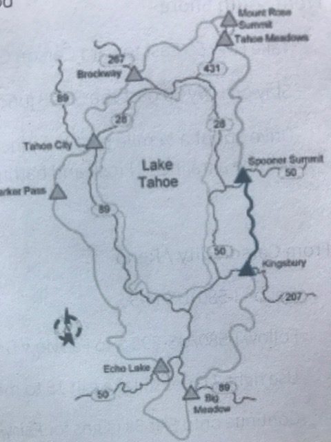
Segment 11: Echo Lakes to Bayview
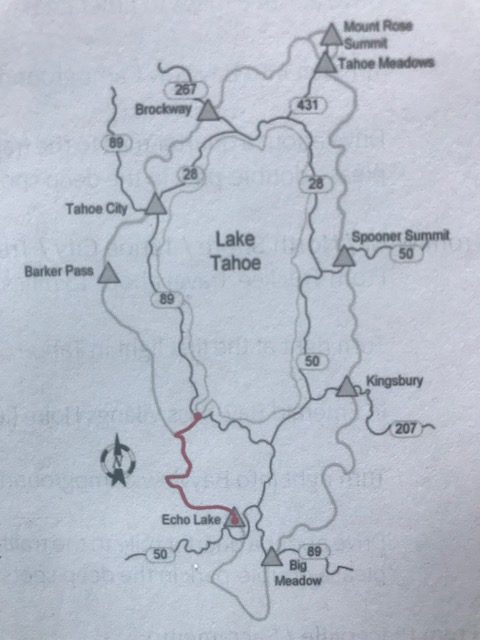
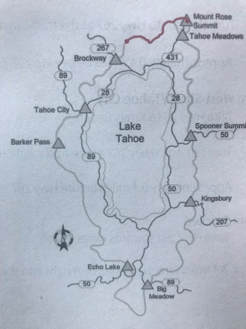
Map: Echo Lake to Bayview
Miles: 21.2
Hours: 11 hours, 34 minutes
Highest Altitude: 9,380′ (Dick’s Pass)
Ascent: 3,026′
Date: September 2nd, 2018 *7 hikers out of the 10 in our group finished TRT today!
Hike Rank: 4
Favorite Flower Sighting: Sierra Gooseberry
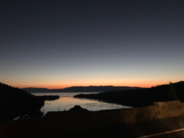
Sunrise above Emerald Bay
Even though this was the toughest trail, the views were incredible. It begins meandering alongside Upper and Lower Echo Lake, in beautiful terrain and gradually climbs above the lakes into Desolation Wilderness. Sierra Gooseberry with its prickly but guava-flavored fruit appeared in several spots along the shaded sections of path. Arriving at Lake Aloha was like landing on the moon. It’s made of numerous small pools, edged by flat white rocks. We then descended to Heather, Susie and finally Gilmore Lake where we stopped for lunch and a few of us jumped into the refreshing water.
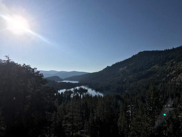
View of Echo Lake
A park ranger asked us to divide our group of twelve into several smaller groups, so we didn’t disturb the wilderness experience of other hikers. I wasn’t sure why it made much of a difference but we followed her request.
The climb to Dick’s pass was tough since the switchbacks never seemed to end and we were ascending during the full heat of the afternoon sun.
Top of Dick’s Pass
I was in the group in front, in a push to get the big climb over with. We reached the top, took a few photos, and then were rushed to keep moving so the group stayed divided. Unfortunately, one of our group members was recovering from a cold and became sick from the elevation. She had to move slowly and so we waited below the pass for her and the rest of the group to find us. Once together again, a faster hiker in our group volunteered to carry her pack and we set off. We moved slowly, especially down the steep, rocky descent into Bayview Campground, but the group finished, 11 hours and 34 minutes later. Greeted by champagne and snacks, we tried to revive enough to celebrate the completion of the trail by most of the group and our final hike together. We had bonded after 11 weeks of sweating and talking along the trail together, and it was a bittersweet goodbye.
Favorite Flower Sighting Summary – In order of hikes
Snowplant (Sarcodes sanguinea)
Thimbleberry (Rubus parviflorus)
Sierra Juniper (Juniperus occidentalis)
Corn Lily (Veratrum californicum)
White Pine (Pinus monticola)
Aspen (Populus tremuloides)
Mountain Pennyroyal (Monardella glauca)
Rubber Rabbitbrush (Chrysothamnus nauseosus)
Mule’s Ears (Wyethia mollis; Wyethia angustifolia)
Fireweed (Epilobium angustifolium)
Sierra Gooseberry (Ribes roezlii)